Priority Zone-Mapping for Reforestation in the Montane Dry Forests of Bolivia – Case Study of Micani
Master’s thesis by Larissa Böhrkircher
Supervised by:
Prof. Dipl.-Ing. Christa Reicher, Chair of Urban Design and Institute for Urban Design and European Urbanism
Professor Dr. Michael Leuchner, Faculty of Geography
Fabio Bayro Kaiser, Chair of Urban Design and Institute for Urban Design and European Urbanism
Thesis Abstract
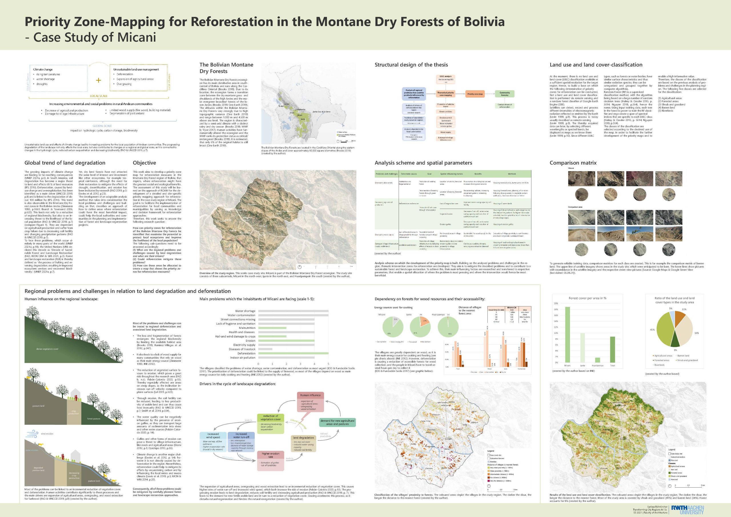
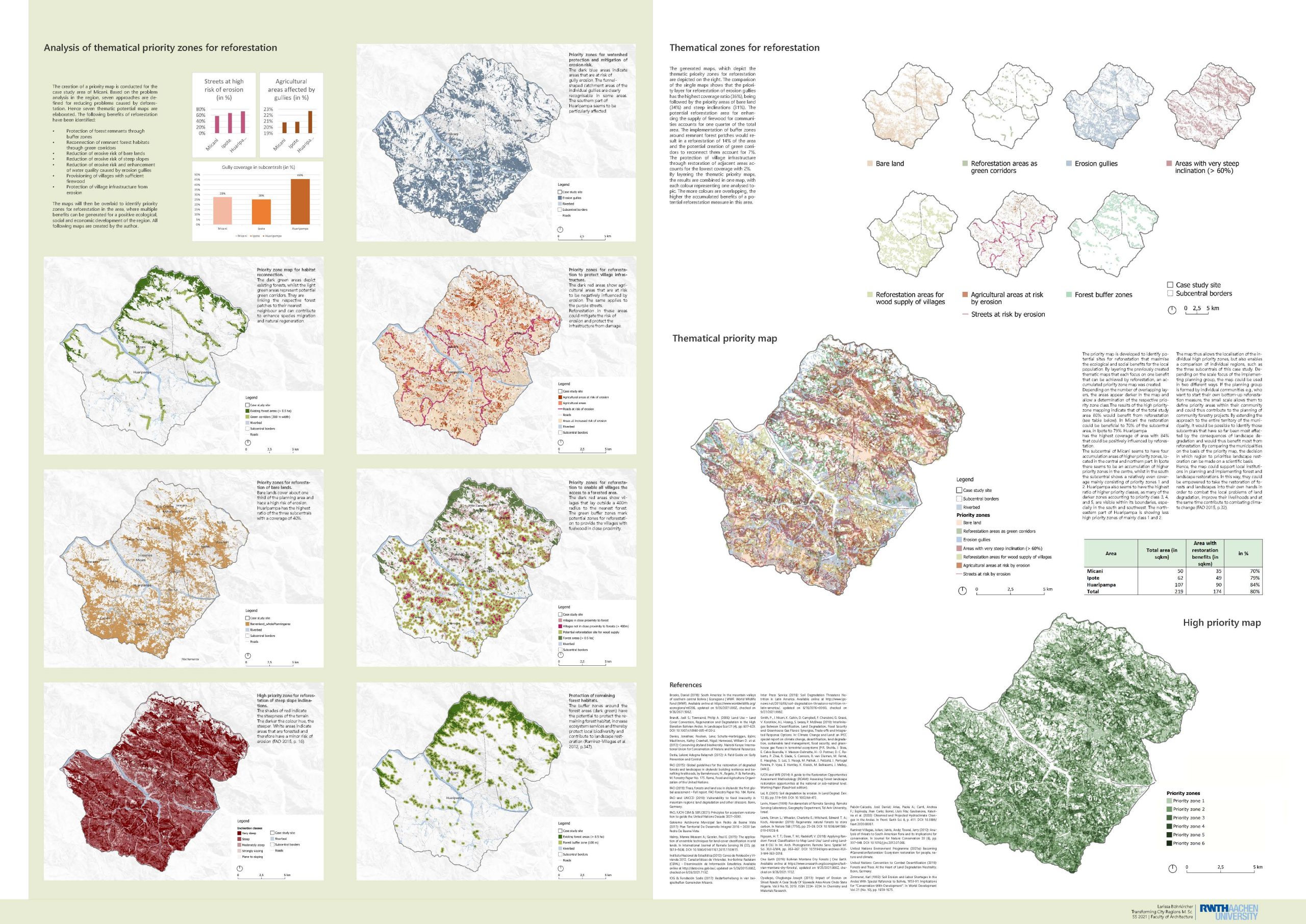
The Andean dry forest ecosystems of Bolivia are due to insufficient land use methods and deforestation in a fast progress of landscape degeneration. This process has negative effects for the local population, the regional biodiversity as well as the regional and global climate. Reforestation is a way to counter landscape degeneration, but dry land forests have not attracted the same level of interest and investment like other ecosystems and the implementation by local governments is low. To facilitate the initiation of reforestation for local communities and municipal governments, this study aims to develop a priority zone map for reforestation measures in the Montane Dry Forest region of Bolivia, that depicts, where reforestation might have the greatest social and ecological benefits. The research is performed by a case study analysis. To develop the priority map, a problem analysis of the region is conducted and based on it, thematical reforestation benefits are determined. Using remote sensing methods and GIS, the areas where benefits can be obtained are mapped for the case study area and compiled into a final priority map. The resulting map shows, that 80% of the case study area would benefit in at least one way from reforestation measures. It further identifies areas where reforestation would achieve multiple benefits. Based on this, the concept of priority maps could be used to facilitate reforestation strategies by local communities and municipal governments and could thus contribute to initiate an integrated forest and landscape restoration of the Bolivian mountain dry forests.